Day Thirteen , 9th Sep
Guess what we did today, yes we continued to tour the D Day sights, on the way we passed a Lidl, and stopped for essential provisions, beer and chocolate mainly.
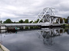
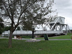
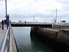
We started by finding Pegasus Bridge on the Caen Canal, between Caen and Ouistreham. The signposts to the bridge were few and far between, we passed and had to double back to find it. The bridge over the canal now, is a wider replacement put there in 1994, the original is outside a museum next to the canal and you have to pay to walk on it. We parked close to the museum and walked over the new bridge, which is a bigger version of the original.
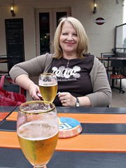
Oevr the bridge we popped into one of the bars there, Les 3 Planeurs, the 3 gliders (mainly to use the facilities) and had a beer, we really should have had one in the bar opposite, as it had more history but it was very busy. It was the first house to be liberated during D-Day and is now Café Gondrée. After our beers (and using the facilities again), we walked back over the bridge to see where the gliders landed early on D Day.
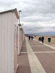
We looked around the landing sites, very close to the bridge they must have been great pilots and then back to the car. As we were already well on the way there, we decides to look in on Holgate, the place we usually camp when we are in Normandy. It hasn't changed, we walked along the front and through the shops, I even bought beer. There was a house for sale on the front, if I win the lottery, it's mine.
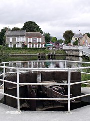
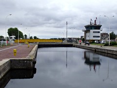
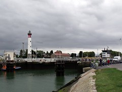
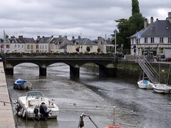
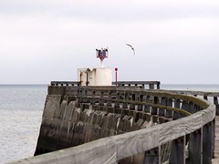
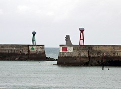
We then headed back over Pegasus Bridge and on to Ouistreham, where we parked for a look round, I hadn't realised the Cean ferry docked here and not Cean. There were a few motorhomes parked, presumably waiting for the ferry and we saw a couple of Aires (overnight parking for motorhome) as well. We wandered over the canal lock gates, had a look at the lighthouse and watched the people fishing.
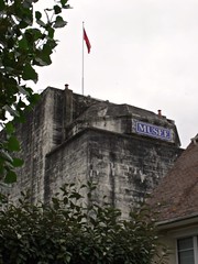
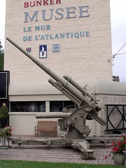
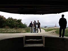
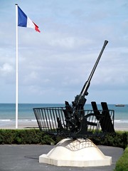
We move further round the front to the other side of the ferry terminal and found nothing interesting but just as we were driving off, we spotted a large concrete building. We parked up again and went for a look, it was, Le Grand Bunker, a German command post for the Atlantic Wall and now a museum. we were too late to look round but there were lots of old artillery pieces around the courtyard.
From there we drove along the coast (Sword Beach), stopping at the various memorials along the way, we got as far as Saint-Aubin-sur-Mer (start of Juno Beach), then turned towards Bayeux and the campsite.
Back at the campsite the sun was out, so we pulled over at the bar and had a beer outside in the sun.
Friday, 28 October 2011
Wednesday, 26 October 2011
France Sep 2011, Day Twelve
Day twelve, 8th Sep
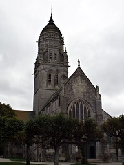
Another day out, driving around the D Day sights, this time we headed south and found the Omaha and Utah beaches. As usual for this holiday we just drove to the general area where we thought the sight we were looking for should be. As we drove towards the coast there were the signs for Utah beach, so we started to follow them. In a village along the way (Sainte-Marie-du-Mont), I spotted an interesting looking church and stopped for a photo, as the tower looked a bit different from the norm.
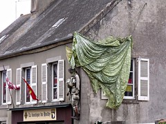
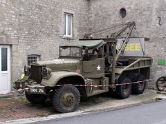
While taking photos I discovered Sainte-Marie-du-Mont, was the scene of military engagement between the American 101st Airborne Division and the Germans on D-Day, June 6, 1944. Then Dot pointed out a dummy hanging in a parachute from a shop front and an armoured pickup around the corner, I took some more photos before we continued to the beach itself.
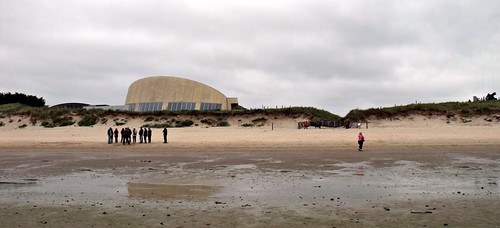
We arrived at the car park behind the museum at Utah beach, the parking, unlike yesterday, was free but the museum wasn't. There are many D Day museums in Normandy and all I found, charge an entry fee, if you visited them all it would be expensive.
Anyway all I wanted to see was the beaches, to see where it all took place and if we wanted to see hardware, there were armoured vehicles and guns all over the area to view. It was cold and windy on the beach and after a look round the monuments, we were glad to get back to the car, we then drove a bit further along the coast and parked up for our picnic lunch.
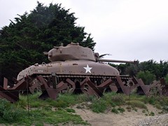
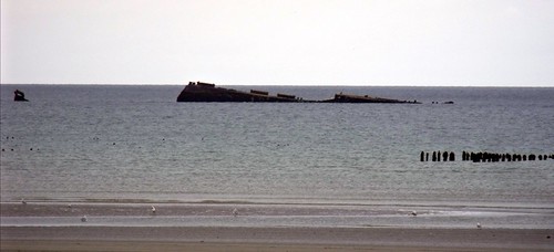
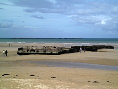
Where we parked there was a tank in the car park and a way through the dunes to the beach. It was still cold, so Dot got the food ready while I had a walk to look at the beach. I found the remains of another temporary harbour, I think there were six of these Gooseberry temporary harbours, two of them became the Mulberry harbours. I think this one may have been Gooseberry 1.
After Lunch we continued along the coast stopping off at intervals for photos, we got as far as the small village of Le Havre, checked out a campsite there and then headed back to look for Omar Beach.
Heading north to find Omaha Beach (the beaches actually run east - west), we first stopped in Isigny-sur-Mer to look at the river and found an Aire there. Next we sopped in Grandcamp-Maisy on the coast, the weather must have been improving as we walked along the pier, this is a place we will have to visit again as we missed all the D Day history there.
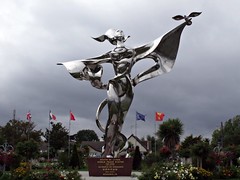
On the road out of Grandcamp-Maisy, we had to stop to see what the big silver statue was for, we parked up and wandered over for a look. It was the World Peace Statue, by Chinese artist Yao Yuan, I believe it was unveiled during the 60th anniversary celebrations for D Day.
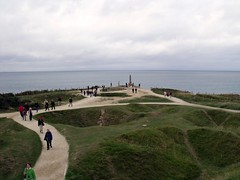
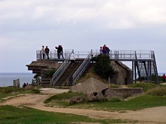
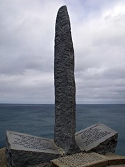
We found Pointe du Hoc by accidental and it was one of the highlights of the day. Pointe du Hoc (or Pointe du Hoe as it was known by Americans after a spelling mistake), is a promontory situated between Utah Beach to the west and Omaha Beach to the east and in 1944 it was covered with German gun emplacements.
A USA Ranger battalion took Pointe du Hoc on D Day and it is now owned by the USA government, it has a memorial and museum, as well as all the old gun emplacements and shell/bomb craters. It takes quite a while to walk round the entire site, and the full story is tragic, history shows there was no real need for the taking of Pointe du Hoc. Its a long story see here, http://en.wikipedia.org/wiki/Pointe_du_Hoc
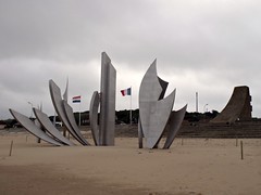
We then drove to Vierville-sur-Mer, then down to and along the coast, we parked up to view the D Day monument on Omaha Beach. Les Braves by Anilore Banon, I have seen photos when the tide is in, and it looks better with the see around it
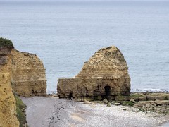
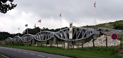
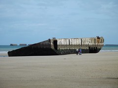
We drove back out the way we came to take a photo of one of the landing bridges, that is by the side of the road close to the Omaha Beach.
On the way back to the campsite we stopped at a bar in Cerisy-la-Forêt for a beer, this was the closest bar to the campsite, about three miles away. Opposite the bar we spied a small shop and popped in for some bread, I also got six cans of Kanterbrau, I drank them all that night back in the mobile home.
Tuesday, 18 October 2011
France Sep 2011, Day Eleven
Day eleven, 7th Sep
We have been to Normandy four times now and never visited the D Day beaches, today we would put that right. Although we didn't have a plan, we just drove towards the coast and thought we would just see where we ended up. On the Bayeux ring road we passed a very large supermarket and made a note for future reference.
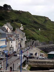
The first place we ended up was, Port-en-Bessin-Huppain, the place where on D Day+1, troops from Omaha Beach linked up with the 47th Royal Marine Commandos, who had struggled its way from Gold Beach. Of course we didn't know any of this when we were there, I found it very hard to find information on the landings. Even in the tourist information building but we had a nice walk round the place anyway.
We had a look to see if there was anything we fancied for lunch and nearly got poulet baguette sandwiches but there were a lot of wasps, walking on the food in the display cabinets, we changed or minds. If you have read any of my stuff before, you will probably know that if there is a pier, we will usually walk to the end of it, well this time it was just too windy for that.
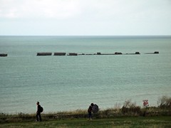
We moved on, driving north along the coast until we came to Arromanches-les-Bains. I was wondering where the remains of the Mulberry harbour where, well it was pretty plain to see as we drove in, they were here. We parked to the north of town, next to a museum with great views of the harbour from the cliffs, we did have to pay though. Port Winston at Arromanches, or the Mulberry harbour, was a British type of temporary harbour developed in World War II to offload cargo on the beaches during the Allied invasion of Normandy. The harbour had been a lot bigger than I though and a lot of it was still in position after all this time.
It was still very windy and the weather couldn't make it's mind up as to rain or not but we walked down the steep path into town anyway and the sun came out when we got down there.
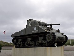
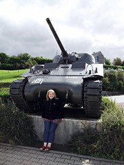
I took a photo of Dot next to a tank on the way down and had a rest, if it was hard going down, how were we going to get back up. At the bottom of the cliffs we went straight on to the beach to look at the remains on the beach, while the tide was out
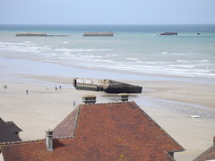
Down on the beach the parts of the harbour you can get to are very big pieces of equipment indeed, it must have been a fantastic sight in use and was an amazing feat of engineering.
We had a long walk along the beach and Dot had to have a plodge in the sea before we headed back into town to find something to have for lunch. We got a chicken baguette and a baguette pizza, we waited an age for the lady to warm the pizza, which was a waste of time because it was still not hot. We sat on the sea front and sheared the food then went back and looked in the souvenir shops.
We took a different route back up to the car park, it didn't seem to be as steep, it was starting to get windy again so we headed back to the campsite. We called in to the large supermarket we made a note of earlier in the day and spent quit a lot of money. I was charged for four boxes of Leffe when I only bought two, to make it easier for customer services, instead of a refund, I just took two more boxes of Leffe, it won't go to waste.
On the way back into the site we parked at the bar and went in for a drink, it was even more expensive than the previous site about 15% more for two beers. We did have a couple though, before going back for supper.
Saturday, 15 October 2011
France Sep 2011, Day Ten
Day ten, 6th Sep
We were all up early and on the road, Ralph and the girls heading for the ferry home and Dot and I heading for Siblu's Domaine de Litteau in Normandy.
Our plan was to not take any toll roads at all and to stop along the way for a picnic lunch, I chose Laval for the picnic and planned the route accordingly. The reason for choosing Laval, was that I once saw a photo of the river there and though it would be nice to visit someday.
We made our way via back roads to the D766, then through Château-Renault, Saint-Laurent-en-Gâtines, Neuillé-Pont-Pierre and Beaumont-la-Ronce to Château-la-Vallière where we joined the D959. Driving the "D" roads may allow you to see more of France and pay less but it is harder on the driver than the toll roads are. The road name changed for no reason at all from the D959 to the D306 until Bouessay, where again it changed for no reason to the D21 all the way to Laval.
I had programmed into the GPS a car park by the river Mayenne in Laval, between two of the bridges, luckily there was plenty of room there but it was a pay on exit type of car park.
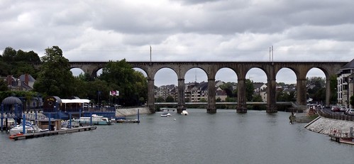
I hopped out to take some bridge photos while Dot got the picnic from the cool box . I went to walk under the Pont de l'Europe, for a better shot of the viaduct but stopped in my tracks, as there appeared to be a druggie under the bridge preparing his next fix. I went straight back to the car
Instead of having lunch just then, we decided to walk along the river in the opposite direction from the druggie, also I needed to use a toilet, soon. When travelling in the van, the need for the toilet is not a problem, we can pull over any time, just about anywhere and use the one in the van, today I have to find one.
Found a nice square just up from the river, with gardens, a fountain (that was no help), statues, a carousel and to my relief, toilets. Pretty disgusting toilets though and shared as well but when you gotta go, you gotta go.
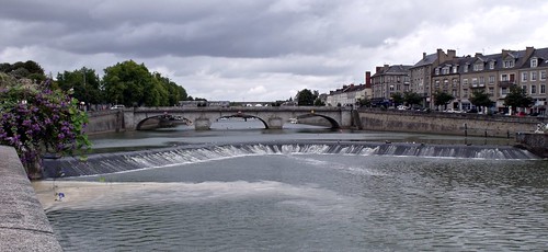
We then continued to walk along the river, taking photos of the many bridges as we went and the sun even came out.
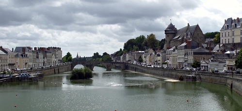
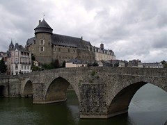
After taking photos of the 14th century Pont-Vieux de Laval and the Château Vieux, we set off back towards the car and lunch. As the sun was trying to to do its job I took as many photos on the was back to the car as well.
As we sat in the car having our picnic lunch, a guy came and stood in front of our car and had a pee into the river, lovely view.
When we were ready to continue our journey, I took the car park ticket over to the pay machine and found there was no payment due, bargain.
Back on the road and out of Laval onto the N162 to Mayenne, where we switched on to the D23, along the way this changes to the D962. Domfront on this road looks very picaresque, just before Saint-Bômer-les-Forges, we took the D54 to the D924, through Tinchebray then another name change D524. Just before Vire, we turned onto the D407 bypassing the town, the D407 changes to the D674, then on a roundabout under the A84 we turned onto the N2174. In Torigni-sur-Vire we took a right onto the D13 then left onto the D34 until we found signs to the campsite. It was beginning to rain as we arrived.
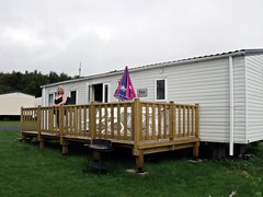
The accommodation was very nice, loads more room than the last place and far superior fixtures and fittings. By now it was raining hard, and I got wet setting the satellite up, as usual there was an England football match on.
There was already a match on when I got the sat on so I watched that before the England game. England beat Wales 1 - 0, not a great game but better than losing and now we only need a drew in the next game to qualify.
We were all up early and on the road, Ralph and the girls heading for the ferry home and Dot and I heading for Siblu's Domaine de Litteau in Normandy.
Our plan was to not take any toll roads at all and to stop along the way for a picnic lunch, I chose Laval for the picnic and planned the route accordingly. The reason for choosing Laval, was that I once saw a photo of the river there and though it would be nice to visit someday.
We made our way via back roads to the D766, then through Château-Renault, Saint-Laurent-en-Gâtines, Neuillé-Pont-Pierre and Beaumont-la-Ronce to Château-la-Vallière where we joined the D959. Driving the "D" roads may allow you to see more of France and pay less but it is harder on the driver than the toll roads are. The road name changed for no reason at all from the D959 to the D306 until Bouessay, where again it changed for no reason to the D21 all the way to Laval.
I had programmed into the GPS a car park by the river Mayenne in Laval, between two of the bridges, luckily there was plenty of room there but it was a pay on exit type of car park.
I hopped out to take some bridge photos while Dot got the picnic from the cool box . I went to walk under the Pont de l'Europe, for a better shot of the viaduct but stopped in my tracks, as there appeared to be a druggie under the bridge preparing his next fix. I went straight back to the car
Instead of having lunch just then, we decided to walk along the river in the opposite direction from the druggie, also I needed to use a toilet, soon. When travelling in the van, the need for the toilet is not a problem, we can pull over any time, just about anywhere and use the one in the van, today I have to find one.
Found a nice square just up from the river, with gardens, a fountain (that was no help), statues, a carousel and to my relief, toilets. Pretty disgusting toilets though and shared as well but when you gotta go, you gotta go.
We then continued to walk along the river, taking photos of the many bridges as we went and the sun even came out.
After taking photos of the 14th century Pont-Vieux de Laval and the Château Vieux, we set off back towards the car and lunch. As the sun was trying to to do its job I took as many photos on the was back to the car as well.
As we sat in the car having our picnic lunch, a guy came and stood in front of our car and had a pee into the river, lovely view.
When we were ready to continue our journey, I took the car park ticket over to the pay machine and found there was no payment due, bargain.
Back on the road and out of Laval onto the N162 to Mayenne, where we switched on to the D23, along the way this changes to the D962. Domfront on this road looks very picaresque, just before Saint-Bômer-les-Forges, we took the D54 to the D924, through Tinchebray then another name change D524. Just before Vire, we turned onto the D407 bypassing the town, the D407 changes to the D674, then on a roundabout under the A84 we turned onto the N2174. In Torigni-sur-Vire we took a right onto the D13 then left onto the D34 until we found signs to the campsite. It was beginning to rain as we arrived.
Domaine de Litteau
14490 Litteau, Normandy
The accommodation was very nice, loads more room than the last place and far superior fixtures and fittings. By now it was raining hard, and I got wet setting the satellite up, as usual there was an England football match on.
There was already a match on when I got the sat on so I watched that before the England game. England beat Wales 1 - 0, not a great game but better than losing and now we only need a drew in the next game to qualify.
Thursday, 13 October 2011
France Sep 2011, Day Nine
Day nine, 5th Sep
The girls wanted to go shopping, so we drove to Boise for the day. We parked the car on the opposite side of the river from the shops and paid for a couple of hours parking.
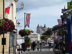
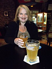
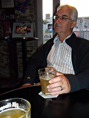
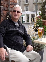
Over the bridge and into the shopping streets, Ralph and I headed to a bar while the girls looked around the shops. We intended to have a beer in a bar we had used in 2009, unfortunately it wasn't open but there was another bar just around the corner. Also unfortunately, unlike the bar we were intending to use, this bar had a very poor choice of beer. The draught beers on offer were, a Portuguese beer, a Dutch beer and a fruit beer from Belgium, not a good selection we chose the Portuguese.
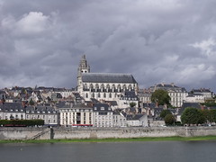
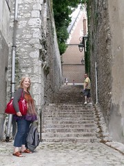
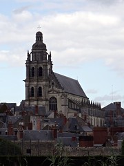
After the beer (we didn't fancy another one), we met back up with the girls and went up to the Château royal de Blois. This involved climbing an awful lot of steps, in the end it was worth it for some nice views across the city rooftops.
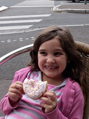
Again as yesterday the sky darkened and it looked like it was going to rain, so we set off for the car. Back over the river it cleared up so we stopped for drinks and ice-creams / cakes in a riverside cafe, before heading back to the campsite.
On the way back I checked out another campsite in Onzain. Back at the site the girls went over to the pool while Ralph and I did our final BBQ together this holiday. Tomorrow Dot and I were moving on and Ralph and the girls were going home.
Subscribe to:
Comments (Atom)
